


.svg)
The United Kingdom is bracing for another significant spell of volatile weather as the Met Office confirms a potent area of low pressure will approach from the South West on Monday, bringing the heightened risk of widespread flooding and severe travel disruption. This latest development follows a weekend already marked by persistent rain and gusty winds, demonstrating the Atlantic’s firm grip on the start of meteorological winter.
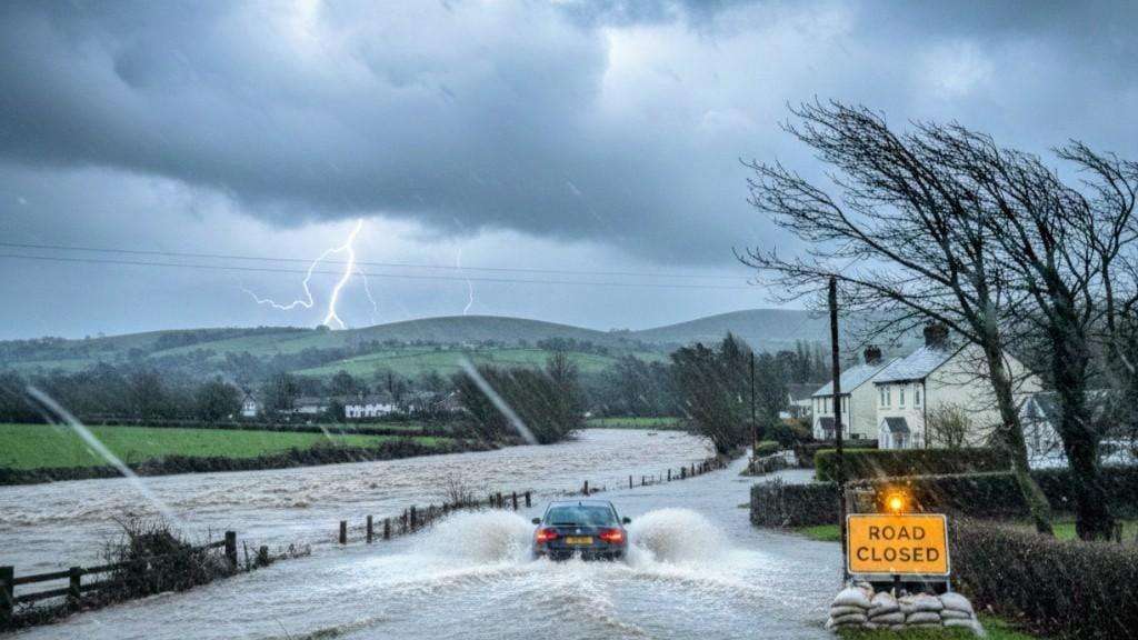
As of Saturday afternoon, the Environment Agency, Natural Resources Wales, and the Scottish Environment Protection Agency (SEPA) had collectively issued dozens of flood alerts and warnings across the three nations. While the initial tally cited 36 warnings (22 in England, 8 in Scotland, and 6 in Wales), updated figures from the Environment Agency in England now show a current total of 15 Flood Warnings (meaning flooding is expected, and immediate action is required) alongside 106 Flood Alerts (flooding is possible). These alerts are predominantly concentrated across saturated western regions, with particular focus on coastal areas of the South West and the North East, including Cumbria, where the ground is already heavily sodden.
Deepening Low Pressure System Triggers Monday Rain Warning
The immediate concern for emergency services and commuters is the arrival of the "deepening area of low pressure" late on Monday, which is forecast to track across the UK, bringing heavy rain and strong winds right through until early Wednesday. In a crucial update, the Met Office has already issued a Yellow Weather Warning for Rain covering parts of South Wales, South and Southwest England, and the Southwest Midlands, active from Monday evening through Tuesday evening.
This yellow warning highlights the potential for the system to cause significant impacts, including further property flooding and extensive delays to both road and rail transport. Met Office Deputy Chief Meteorologist Dan Holley emphasised the complexity of forecasting this particular system, noting that the low pressure is expected to undergo "fairly rapid deepening" as it approaches the UK. This phenomenon often reduces confidence in the exact path and depth, making it challenging to pinpoint which areas will bear the brunt of the heaviest rainfall and strongest winds, particularly across northern and western parts of the country.
Unsettled Conditions to Dominate through Christmas
Beyond the immediate threat of next week’s intense system, the long-range outlook confirms that the jet stream remains positioned to drive a continuous succession of low-pressure systems toward the UK throughout December. This suggests the prevailing theme of wet and windy weather, interspersed with brief, drier interludes, will persist.
While the Met Office previously stated it was too early to give a specific Christmas forecast, recent long-range analysis suggests a likelihood of a changeable festive period with further spells of rain, strong winds, and a possibility of snow, mainly as "hill snow in the north," during the period from December 20th to January 2nd. Despite the persistent wet weather, temperatures are currently expected to remain near or slightly above average for the time of year, tempered by blustery conditions.
Authorities are strongly urging the public to keep a close watch on local forecasts and any updated severe weather warnings issued over the weekend as the exact nature of Monday's disruptive system becomes clearer. Residents in flood-prone areas should take immediate preventative measures, as the ground's saturation leaves the country extremely vulnerable to even moderate rainfall.


.jpg)