


.svg)
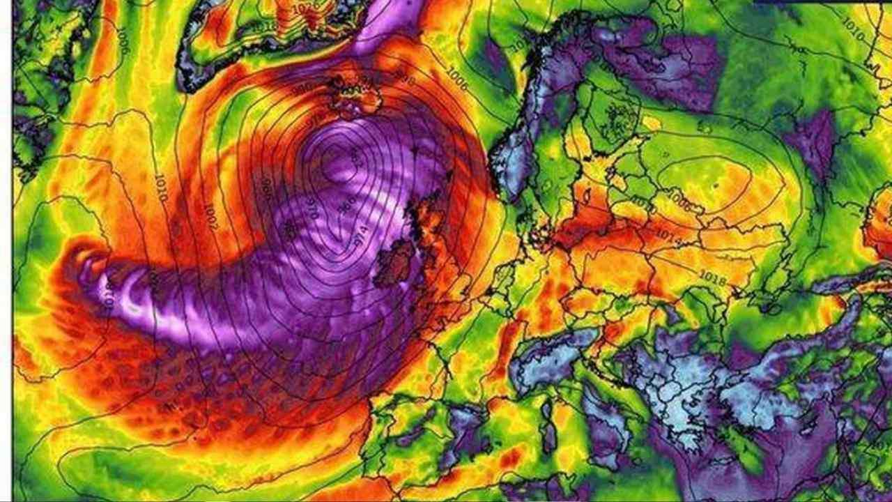
Britain is bracing for a stormy Halloween as powerful winds and heavy rain are set to sweep across the country. Weather charts predict gusts reaching up to 80mph in coastal regions, with the worst conditions expected to strike on Friday night and linger into Saturday morning.
WXCharts data shows that western coastlines will bear the brunt of the extreme weather, particularly parts of England, Scotland, Northern Ireland, and Wales. Northern regions such as Dumfries and Galloway, Cumbria, and County Antrim are already facing strong winds and heavy downpours, while even southern areas like Hampshire could see gusts up to 70mph.
Forecasters warn that the storm will bring around 20mm of rain in some locations, starting from mid-afternoon today. The Met Office has cautioned that travel disruptions on roads, railways, and ferry routes are likely, and coastal communities may experience large waves and sea spray. By early evening, most of the UK is expected to see rain, with western Scotland and the Highlands being hit hardest.
Thursday already brought widespread showers, with nearly 20mm recorded in parts of Northern Ireland and more than 13mm in Pembrokeshire, Wales. These areas are set for another soaking today. Despite slightly milder temperatures that could reach 16°C in eastern England, strong winds will continue through the weekend.
The unsettled weather pattern is expected to carry into next week, as low pressure continues to dominate. The Met Office’s long-range outlook warns of more showers and periods of heavy rain, particularly across western regions, with the potential for further gales or severe gusts.